Faithful readers may remember the visit to the Little Big Horn Battlefield last year. Since our route took us in that direction, we stopped again and saw a few things we missed last time.
I was somehow of the opinion that there is a town at Garryowen MT...nope, just a gas station with a couple of interesting signs.
 |
| This is a memorial to one of Marcus Reno's soldiers, found in 1926, long after the battle. No way to identify him. |
I took the photo below from the 7th Ranch RV Park south of the battlefield. We saw miles and miles of this in a landscape little changed from what Custer saw in 1876...except there were no Native American warriors.
When we left the Garryowen area, we drove south to Sheridan and stayed one night. The next day we went back north to turn west on US Alternate Highway 14, a route through the mountains which took us over to Cody. Another incredibly beautiful drive through National Forest and mountains. When we finally reached the top, there was a highway sign stating that there is a 10% grade for miles, all the way down. Lots of emergency ramps for out-of-control vehicles and they all looked well used.
Found our way to Cody WY and were ready to slow down for a bit. Well, maybe not. Our first full day here we drove the Chief Joseph Scenic Byway and turned onto the Beartooth Pass All American Highway.
Chief Joseph Highway
Beartooth Highway
Not a road for the faint of heart. Steep, twisting, lots of switchbacks, just wide enough for two vehicles to pass. Even Mike was tired at the end of it. (It's one of the few places we've been that he hadn't already seen.) Relatively few vehicles on it, as opposed to the Manhattan-at-rush-hour we saw on Going to the Sun Road at Glacier Park. Easily just as beautiful and a whole bunch more fun without thousands of others on the road with you.
When we got back to Cody, it was only early afternoon so we headed west to Yellowstone to scope out the park where we will stay for five days beginning Friday.
There is a large lake on the way to Yellowstone created by the Buffalo Bill Dam. As you can see from the photo, it's very beautiful. Both of us were surprised that we saw no boating of any kind on the lake; no kayaks, no canoes, no rowboats, no rafts, nothing. And it's a very large lake.
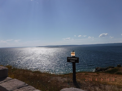
We found the RV park easily and were returning to Cody when we stopped at this scenic outlook. We had noticed what we thought was smoke from a fire just to the right of this photo. Nope, it was a thermal vent. What we thought was smoke was steam. There's a fracture line along this part of the lake and you can see these little vents occasionally.
The sign in the photo says that the lake's surface is so cold you would die quickly of hypothermia if you fell in; its bottom is so hot from the steam vents you would be scalded (assuming you hadn't drowned first...the lake is 480 feet deep at it deepest point.)


No comments:
Post a Comment