The trailer is roughly broadside to the afternoon sun so erecting the screen room became a necessity as the weather continued to warm. We will need to take the screens off before we leave for the summer as the monsoon winds in August can top 50 mph. Leaving the screens in place guarantees they will be in shreds when we come back in October.
It's amazing what you look at and don't see. I have had this 5 gallon bucket for quite some time. Recently as I sat outside staring aimlessly around, I looked at the bucket. Have IQ's dropped sharply in recent years?
We didn't ride much at all in February, partly because there was so much to do with the trailer and partly because the weather turned ugly. On one of the last rides, we passed through Saguaro Squeeze.
We also did a reconnaissance run on Tank Pass but decided not to run it that day as we were running out of time. Plans are to run Tank Pass before we leave in a couple of weeks. Local lore says the pass was built by Patton's tank trainees to get from their base at Bouse to the local entertainment district in Salome.
 |
| Upper Tank Pass |
Ugly weather, in this context, means chilly (highs in the 50's) and windy, with some rain and overcast. As I write this today, we have overcast, sprinkles, and cooler weather. Yesterday when we were out in the desert it was beautiful.
We have tried twice to find the trail which leads up to the top of the ridge in the Little Harquahalas. Failed miserably. (Those of you who read the blog regularly will recognize this is a problem we have had several times.) Since we could not find it from the highway side, we decided to go to the other end of the ridge (through the whoop-ti-dos mentioned in an earlier post), up the mountain and then turn back west. We had looked at this trail earlier and it appeared to be more dangerous than I feel I can do. We talked with our neighbor who said that it is not dangerous but it looks that way from where we were.
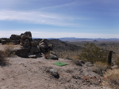
We started up the trail and saw a group of four rigs heading down. Since we were at a point where we could move off the trail (trails are one lane only), we got out of the way and let them pass us. Now that I saw rigs running the trail, I felt I could do it. Our neighbor is right: it looks a lot steeper than it is. We crested the ridge and found the area with the flag. There was a group there having lunch so we didn't stay. Before we left them, they told us to look for another left turn which will take us to a very scenic spot called Picnic Hill. More on this later.
As we made our way west, we encountered cross trails in every direction. It was just a guess which one to take to find our way back to the highway as much of the time the highway was not visible.
We went up, down, left, right, doubled back when we hit dead ends. By sheer luck we hit the right trail to Picnic Hill. Really spectacular views. As at the flag stop, someone had placed a bucket of golf balls and an old club at the edge of a cliff. Apparently launching golf balls into thin air is a popular pastime.
Mike played golf two or three times a week for years until his back gave out. The temptation was just too much: he stepped up to the tee, placed a ball, took a mighty swing...and missed completely. On his next try, he launched the ball into space.
If you look carefully, you will see palm trees to the right of the center of the photos. That's Ramblin Roads RV Resort.
We continue to do battle with the dreaded Cholla. Indy rides in the passenger seat of Mike's rig. I noticed that Mike must have bumped a cholla on the trail as there was a chunk of it stuck in a tire. The next time we stopped, we saw that the tire had flung the cholla up and into the passenger seat. Must have just missed Indy's head.
 |
| Suicide Hill |
There is a particularly dangerous trail which we have passed several times. Our neighbor says there have been some serious crashes on this. He told us to look at the trail which goes up to the left of Suicide. We took a look and decided it was no improvement. Two trails we will not be taking.
The park shuts down for the summer at the end of March. We have plans to leave here March 24, getting into Deming March 25. After a couple of months there, we'll head to higher elevations with the rigs to get out of Hidden Valley's unbearable heat.


No comments:
Post a Comment