Wednesday, August 24, 2016

Yellowstone Part 2

The Grand Canyon of the Yellowstone


Upper Falls

Lower Falls


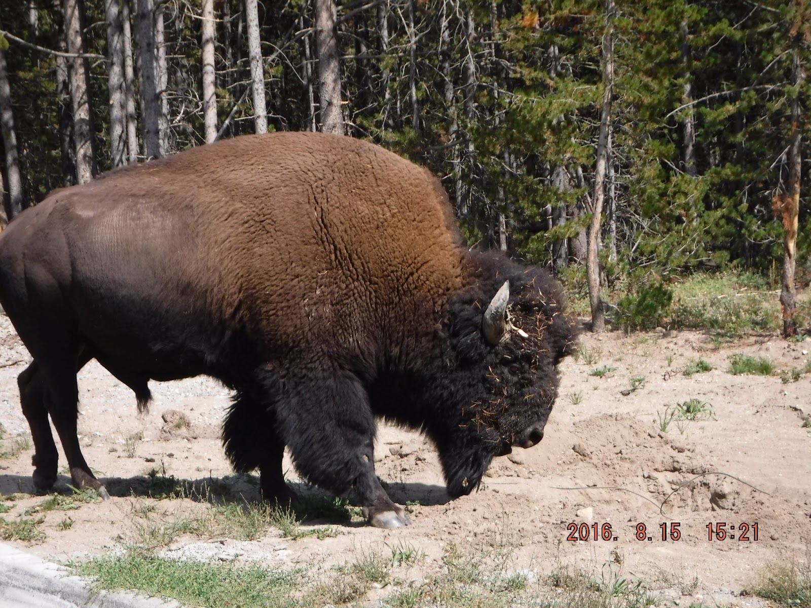
As we were driving from the Fishing Bridge RV campground to the Grand Canyon, we encountered a buffalo traffic jam which held up traffic for probably 30 minutes.  We talked to a guy who said he got caught after dark for over an hour and didn't even get to enjoy watching them.  


Why does a buffalo cross the road?
We went north another day to see Mammoth Hot Springs.  On the way, I finally got to see a big horn sheep!  Cars were stopped on the road (not much of an accident hazard...).  


Mammoth Hot Springs is far larger than I envisioned in my wildest thoughts.  We drove around and up the slope behind it so I could get photos shooting down and across.


The ground looks solid but it is not and there are warning signs everywhere telling visitors to stay on the road or the walkways.  Somewhere in the park there's a sign stating that 12 people have died from breaking through and dropping into the scalding water. 


Yellowstone Part 3 and Grand Teton National Park

Mike's truck was exhibiting some issue with the transmission so we found a Dodge dealer in Jackson, WY, and drove down from Yellowstone just east of Grand Teton National Park.  We started out fairly early in the day and found this guy grazing by the side of the road.  We had wondered where the stags were, as we had seen lots of elk cows and calves but no stags.  They stay in the high country until fall when the velvet falls off the antlers and they fight for breeding rights with the cows.


Note the velvet hanging from his antlers.  He's not quite finished rubbing it off.  The passing cars and gawking tourists didn't seem to phase him at all.  He passed so close to the truck I could have reached out and touched him.  Good luck this fall, big guy!

Returning from Jackson, we detoured into Grand Teton National Park.  Same traffic and crowd problems we have encountered in all the national parks so far.  Couldn't even get close to the visitor center.  We drove north to an area where we could picnic and then drove south along the shore of Jenny Lake.  


Beautiful, clear lake, and quite cold.  We did see a few brave souls dangling their feet but it must have been freezing.  

Imagine our surprise, as we turned into the campground, to be greeted at the entrance by this guy.  His name is Henry and he likes to visit Fishing Bridge Campground fairly regularly.  


Biscuit Basin

Our last day in Yellowstone we headed over to the southwest part of the park in the general vicinity of Old Faithful.  We got lucky and found a parking spot in the Biscuit Basin area.  Below are photos I took.  This entire area is eerie...steam vents, small geysers, scalding hot pools.  


Notice that there is a railing only on the section of the boardwalk closest to the parking lot.  I saw several tourists taking photos or selfies who could easily have stepped off the boardwalk.


Sapphire Pool

We tried to see two different areas called paint pots.  Traffic was the Wild West, with cars parked ON the road, blocking the outbound lane.  After waiting for some time to progress, when we got to the parking lot, we saw the problem.  Mike somehow turned the truck around (?) and we exited without seeing the paint pots.

This brings me to my final thoughts on the national parks:  they are out of control.  In Canada, you buy a pass for a date; and they check the receipt when you are in the park.  If your receipt is expired, they politely but firmly point you toward the exit.  They have traffic "cops" everywhere getting people in and out of the lots and keeping people from parking illegally and blocking the roads.  At Lake Louise, they actually close off access to the park when the numbers hit a certain level.  

Our national parks do nothing of the kind.  Just let enormous tour buses with dozens of visitors block parking lots and roads, ignore cars parked in areas which block access, look on benignly at the traffic and congestion chaos.  

If you are planning a trip to a national park, plan to go the first two weeks in May or the last two weeks in September.  You may actually get to see the park.  June, July, and August are increasingly impossible.  After this trip, I am done with the national park system.  We have found that the national monuments and national forests have far fewer visitors and in many cases, are just as beautiful. 

Cody WY and Yellowstone Part 1

Cody WY and Yellowstone

We stayed a couple of nights in Cody waiting for our reservation date in Yellowstone. 

Last year, constant readers know, we had a flat tire on the way to Durango CO.  Well, the tire bought to replace the flat went bad on us.  We ordered a new tire on Walmart online and needed to pick it up at the Walmart in Cody. 

What an experience.  One never knows when one pulls into the Walmart parking lot what one will find.  This one had the sculpture below.  A mere $75K, in case you are looking for a new yard ornament. 


When we inquired about the tire, no one at Walmart knew anything about it.  They recommended I check the website to see where it was.  Well, two days later, we discovered the tire in the Walmart store in Cody WY and it had been there the whole time.  Hhhhmmmm.   But we got the tire on the truck and we are back with four good tires now. 

Cody is an interesting little town, full of Buffalo Bill sites and history.  The Irma Hotel was built for Bill’s girlfriend, Irma.  


Without its close proximity to Yellowstone, Cody would be a much different place.  I doubt that the Buffalo Bill association would be enough to draw thousands of tourists through there every year. 

As we started up the highway to Yellowstone, we stopped at a memorial to firefighters killed in a wildfire in 1937.  At the time I write this, there are five wildfires in Yellowstone. Incredibly 
dangerous work for anyone brave enough to attempt it.  


There are wildfires all over the West and probably not nearly enough fire crews to work them.  I overheard two ladies’ conversation in the grocery store in Cody.  One asked the other, “Did  you get burned out?”  Obviously, the second lady had a home in the fire area.  Fortunately, the answer was “No.”  As we left Yellowstone through the south entrance, we encountered smoke from the fires burning around Jackson.

There are signs and posters EVERYWHERE warning of the danger of the Yellowstone bears.  (Note:  We saw NO BEARS in Yellowstone.)  Curiously, there is no information about mountain lions, and I was sure there must be cougars somewhere in the park, with the large deer and elk populations.  I asked at one of the visitor centers and was told the cougars are in the far north of the park and are rarely seen in the visitor-heavy area.  Good thing.


It is an unsettling feeling to look across the landscape here and see the plumes of steam from the vents.  You get the sense you are standing on top of an unimaginable power source which could blow at any time.  Yellowstone (as you all know) is a super volcano which hasn’t erupted in 600,000 years.  I am sure there are monitors all over the park but since Mt. St. Helens blew up without warning, so much for monitoring. 


Wednesday, August 10, 2016

On the Road to Yellowstone

After Glacier National Park, we are working our way over to Yellowstone National Park, another bucket list item for me.  

Faithful readers may remember the visit to the Little Big Horn Battlefield last year.  Since our route took us in that direction, we stopped again and saw a few things we missed last time.  

I was somehow of the opinion that there is a town at Garryowen MT...nope, just a gas station with a couple of interesting signs.


This is a memorial to one of Marcus Reno's soldiers, found in 1926, long after the battle.  No way to identify him.


I took the photo below from the 7th Ranch RV Park south of the battlefield.  We saw miles and miles of this in a landscape little changed from what Custer saw in 1876...except there were no Native American warriors.


When we  left the Garryowen area, we drove south to Sheridan and stayed one night.  The next day we went back north to turn west on US Alternate Highway 14, a route through the mountains which took us over to Cody.  Another incredibly beautiful drive through National Forest and mountains.  When we finally reached the top, there was a highway sign stating that there is a 10% grade for miles, all the way down.  Lots of emergency ramps for out-of-control vehicles and they all looked well used.


Found our way to Cody WY and were ready to slow down for a bit. Well, maybe not. Our first full day here we drove the Chief Joseph Scenic Byway and turned onto the Beartooth Pass All American Highway.  

Chief Joseph Highway


Beartooth Highway

Not a road for the faint of heart.  Steep, twisting, lots of switchbacks, just wide enough for two vehicles to pass.  Even Mike was tired at the end of it.  (It's one of the few places we've been that he hadn't already seen.)  Relatively few vehicles on it, as opposed to the Manhattan-at-rush-hour we saw on Going to the Sun Road at Glacier Park.  Easily just as beautiful and a whole bunch more fun without thousands of others on the road with you.


When we got back to Cody, it was only early afternoon so we headed west to Yellowstone to scope out the park where we will stay for five days beginning Friday.  

There is a large lake on the way to Yellowstone created by the Buffalo Bill Dam.  As you can see from the photo, it's very beautiful.  Both of us were surprised that we saw no boating of any kind on the lake; no kayaks, no canoes, no rowboats, no rafts, nothing.  And it's a very large lake.


We found the RV park easily and were returning to Cody when we stopped at this scenic outlook.  We had noticed what we thought was smoke from a fire just to the right of this photo.  Nope, it was a thermal vent.  What we thought was smoke was steam.  There's a fracture line along this part of the lake and you can see these little vents occasionally.  

The sign in the photo says that the lake's surface is so cold you would die quickly of hypothermia if you fell in; its bottom is so hot from the steam vents you would be scalded (assuming you hadn't drowned first...the lake is 480 feet deep at it deepest point.)


Wednesday, August 3, 2016

Back in Lewis and Clark territory now.


Did you know Montana has ferries which transport vehicles across the mighty Missouri River?  Neither did I.  Mike has been in this area before and knew about them.  We took the day today (8/3) to travel north of Winifred MT to the Stafford McClelland Ferry.  


Missouri Breaks

Stafford McClelland Ferry


The cable in the photo is one of the ones which are used by the ferry.  Current is very swift here.

Anyone who winds up here has REALLY wanted to see it.  It is 17 miles on a gravel road from Winifred.  We drove up the ferry landing and wondered how to get it to come pick us up.  I finally saw a mail box with a sign "CALL HERE."  There was a small walkie-talkie in the mailbox I used to reach the ferry operator on the other shore.

(Note to the Downeys:  this ferry is a much smaller version of the one in Ireland.  Can accommodate two pickup trucks.)


We chatted with the ferry operator during the "crossing."  He said he takes about 100 vehicles a week during the busiest part of the season.  Some are local people but most are just drifters like us.

We drove a few miles on the other side of the river just to see what was there.  Scary road.  Tom (the ferry operator) said you can't use this road at all if it has been raining.  Turns to slimy mud and it's quite steep and twisting.

We are on the top of the cliffs on the north side of the river.


East Glacier Without Fire

Last year we could not complete the Going to the Sun Road because a raging forest fire.  Yesterday we traversed the road from east to west.  Beautiful day, beautiful drive.  We had no more than started up the road when a bear ambled across the road a hundred yards or so ahead of us.  By the time I recovered from my surprise and got the camera, he/she had disappeared into the woods.  Good thing the dogs didn't see it.

The day is coming (soon) when individual traffic will be barred on this road.  It's a traffic nightmare.  Too many cars, shuttle buses, bicyclists (!), motorcyclists.  The road is barely wide enough to accommodate two cars passing and it's bumper to bumper.  Let's hope it is soon.  The Park Service could just limit the traffic during the peak months, June, July, August.  But something really bad is going to happen.  

We tried twice to get into the Logan Pass Lodge.  Rangers wouldn't even let cars into the lot.  


The most interesting shuttle bus company.

The last day, we went to the north end of the park in hopes that the crowds would be fewer.  Nope. Wanted to have lunch at the lodge at Many Glaciers.  Not a parking spot open in a large lot.  

Many Glaciers
Last year's East Glacier Park wildfire was devastating.  Here's what it looks like a year later.


There are miles and miles of the park which look like this.  It will take decades for it to recover.