Saturday, March 10, 2018

Are we having fun yet?

The past two months, since we took delivery of the park trailer, we have spent more time working on it than we have riding trails.  Everything is taking more time (and money) than we had planned.  

The trailer is roughly broadside to the afternoon sun so erecting the screen room became a necessity as the weather continued to warm.  We will need to take the screens off before we leave for the summer as the monsoon winds in August can top 50 mph.  Leaving the screens in place guarantees they will be in shreds when we come back in October.

It's amazing what you look at and don't see.  I have had this 5 gallon bucket for quite some time.  Recently as I sat outside staring aimlessly around, I looked at the bucket.  Have IQ's dropped sharply in recent years?


We didn't ride much at all in February, partly because there was so much to do with the trailer and partly because the weather turned ugly.  On one of the last rides, we passed through Saguaro Squeeze.


We also did a reconnaissance run on Tank Pass but decided not to run it that day as we were running out of time.  Plans are to run Tank Pass before we leave in a couple of weeks.  Local lore says the pass was built by Patton's tank trainees to get from their base at Bouse to the local entertainment district in Salome.  
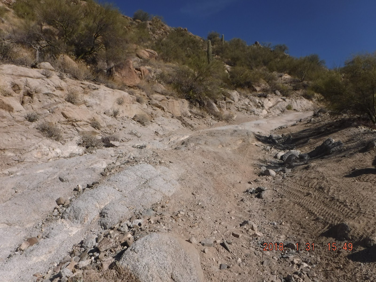
Upper Tank Pass

Ugly weather, in this context, means chilly (highs in the 50's) and windy, with some rain and overcast.  As I write this today, we have overcast, sprinkles, and cooler weather.  Yesterday when we were out in the desert it was beautiful.

We have tried twice to find the trail which leads up to the top of the ridge in the Little Harquahalas.  Failed miserably.  (Those of you who read the blog regularly will recognize this is a problem we have had several times.)  Since we could not find it from the highway side, we decided to go to the other end of the ridge (through the whoop-ti-dos mentioned in an earlier post), up the mountain and then turn back west.  We had looked at this trail earlier and it appeared to be more dangerous than I feel I can do.  We talked with our neighbor who said that it is not dangerous but it looks that way from where we were.

We started up the trail and saw a group of four rigs heading down.  Since we were at a point where we could move off the trail (trails are one lane only), we got out of the way and let them pass us.  Now that I saw rigs running the trail, I felt I could do it.  Our neighbor is right:  it looks a lot steeper than it is.  We crested the ridge and found the area with the flag.  There was a group there having lunch so we didn't stay.  Before we left them, they told us to look for another left turn which will take us to a very scenic spot called Picnic Hill.  More on this later.


As we made our way west, we encountered cross trails in every direction.  It was just a guess which one to take to find our way back to the highway as much of the time the highway was not visible.  

We went up, down, left, right, doubled back when we hit dead ends.  By sheer luck we hit the right trail to Picnic Hill.  Really spectacular views.  As at the flag stop, someone had placed a bucket of golf balls and an old club at the edge of a cliff.  Apparently launching golf balls into thin air is a popular pastime.

Mike played golf two or three times a week for years until his back gave out.  The temptation was just too much:  he stepped up to the tee, placed a ball, took a mighty swing...and missed completely.  On his next try, he launched the ball into space.  


If you look carefully, you will see palm trees to the right of the center of the photos.  That's Ramblin Roads RV Resort.  

We continue to do battle with the dreaded Cholla.  Indy rides in the passenger seat of Mike's rig.  I noticed that Mike must have bumped a cholla on the trail as there was a chunk of it stuck in a tire.  The next time we stopped, we saw that the tire had flung the cholla up and into the passenger seat.  Must have just missed Indy's head.


Suicide Hill
There is a particularly dangerous trail which we have passed several times.  Our neighbor says there have been some serious crashes on this.  He told us to look at the trail which goes up to the left of Suicide.  We took a look and decided it was no improvement.  Two trails we will not be taking.  

The park shuts down for the summer at the end of March.  We have plans to leave here March 24, getting into Deming March 25.  After a couple of months there, we'll head to higher elevations with the rigs to get out of Hidden Valley's unbearable heat.

Sunday, January 14, 2018

The Road to Dripping Springs At Last!!!

Since the holidays, our friends Ron and Sally arrived and we ran Preacher's Pass again from their park.  Another day we went out of this park and ran some fun, rough trails in the Harquahala Mountains.  

Last year with Ron and Sally we tried twice to find the elusive Dripping Springs.  Our first effort ended in a day of frustration and harsh words, as we wandered around in the washes and never did find the right trail.  On our second effort, a day or two later, we finally got to the top of the trail down to the springs but it was too late in the day to run it.  We would have found ourselves coming back in the heavy shade in the late afternoon.  We did the sensible thing, turned around, and said "Next year."
Fast forward a year:  With confidence and high hopes, we started out again to find the springs.  Success!  

The way to the trailhead requires we pass under I-10.  Last year I lost two flags to the culvert so this year we stopped to remove flags.  On the way back, Mike took one of the openings which had sand/gravel washed into the bottom and wound up scraping the roof of his Wolverine.  It was only less than an inch of debris but enough to make the Wolverine too tall for the culvert.


The tenacity of desert plants continues to surprise me.  If you look carefully, you will see a reddish barrel cactus on the cliff face.


Ron and Sally:  how do we get back from here?
There is a very narrow canyon which leads away from Dripping Springs, away from our direction of travel coming in.


Note the photographer's fingers in the mirror.


Ummmm...one little problem.  Once we cleared the canyon and turned east, for a while we had no bleeping idea where we were, GPS units not withstanding.  It was growing later in the afternoon than any of us liked.  Fortunately, Ron got us to the right road for a REALLY SPECTACULAR RIDE back across the mountains to return to the park.


Do  you see the tiny little thread of a trail in the distance?  We came all the way up:  steep, rocky, tilted in spots.  An altogether great ride.

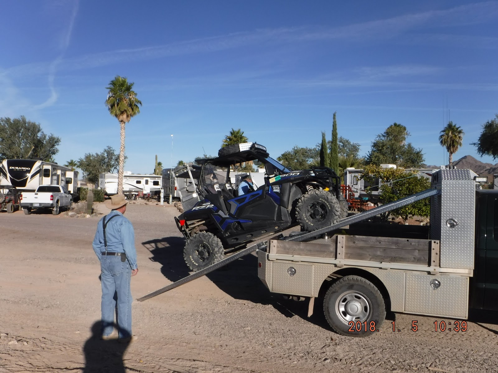
Ron and Sally have a 38 foot toy hauler pulled by their big truck.  They have an interesting way to transport their Polaris when they are unhitched from the toy hauler.  See below.


They are staying at a park down the road so to ride together, either they must haul their rig to us or we trailer our rigs down to their park.

On another topic, we decided to find a larger trailer we can leave in this park permanently.  The weather here in the winter is substantially nicer than in Deming.  We have had one day of rain and most days don't require a jacket.  Today we are waiting for the owners of the trailer to deliver it to us.  Then our work starts, moving items from the Lance to the Cottage.  (It is 40 feet vs the 22 feet in the Lance.)  Our site had to be re-graded to accommodate the longer trailer so we moved the Lance down to an empty site for a few days.


Friday, December 15, 2017

YAHOO!!! ON THE ROAD AGAIN

After a rather dull couple of months at Hidden Valley Ranch in Deming, we left for Arizona and better weather just before the temps plummeted.  The day after we left, temp at night hit 14 degrees at the ranch.

I pull the flatbed trailer with the two side-by-sides while Mike pulls the travel trailer with his truck.  The past two years, we have gone from Deming to Buckeye, AZ, in one shot.  (There is a Walmart in Buckeye which is RV’er friendly.)  This year we decided it’s just too far for me to drive so we stopped at a park in Casa Grande, AZ, for an overnight before going the last 150 miles to Hope, AZ.

Hope, AZ, is a tiny place at the junction of two highways.  There is a gas station/minimart (closed) on one corner.  The RV park and a church are across the street.  We got into the park early afternoon and were getting set up when a guy two sites down walked over.  He had seen the flatbed with the side-by-sides and came over to see if we would like to ride the next day with him and his wife. Mike (another Mike) and his wife Colleen are from Montana. This is their third year here and he knows all the trails.  Like most of the BLM land we've explored, this area has no trail markers; you really need to go out with someone who knows the area until you get a good idea of where everything is.  

We took off following Mike and Colleen and he led us to what is called a Whoop-Ti-Do, a trail which winds in and out of a series of washes.  Fun riding.  Then the trail started up and up and up.  We topped out at a point on a ridge where we could see miles in all directions.  (This is an old mining area so there are lots of trails, much like we have in Deming.)


RV'ers can be quirky, especially when they are bored.  As we dropped down off the ridge and started across the flat, Mike (our guide) said he would take us to some interesting sights.  I believe he said there is a retired engineer in the park who likes to build things in the desert when he runs out of other things to do.  

He built this nice bird bath.  Note the polished stones around the rim.  Mr. Engineer's wife is a rockhound and the park has a lapidary shop.


Someone has to keep putting water in it as there isn't enough rain to keep it filled.  And then....TA DA...THE PYRAMID.


Montana Mike at The Pyramid.
Can you imagine the utter bafflement of some future archeologist who stumbles across this and tries to figure out who built it and why?

Just down the trail from these historic markers are three decorated trees:  The BRA Tree, The HAT Tree, and The STUFFED TOY Tree.  (Did I mention that bored RV'ers find odd things to do?)  I missed getting a photo of the Hat Tree but I did get the other two.  


Obviously there is no grocery store in Hope.  The nearest Walmart is at Parker, AZ, some 50 miles from Hope.  There are dozens of RV parks in Parker or across the river in CA and shopping at Walmart is an exercise in patience.  

At 60 miles from Hope is Wickenburg,Arizona, a charming Old West town, with a Safeway and a couple of very good restaurants, gas stations, hardware stores, etc.  So we went to Wickenburg.

When Wickenburg was an Old West town, they didn't have a real jail.  Local lawbreakers were chained to the Jail Tree.  The photo below is what the Jail Tree looks like today.


The area around Hope has a number of citrus farms.  The park has planted citrus trees, oranges, grapefruits, lemons, at various places along the rows of sites.  At the end of our site is this lemon tree with wonderful fruit.  I fixed shrimp one night and used the lemons from this tree.


Mike and Colleen invited us to ride again with them.  This time there were several other rigs and Mike took us a different way, across the highway to the north.  Great trails.  

We started out with four or five rigs and along the way picked up two or three more.


The Two Mikes discuss the route.
At strategic spots, we stopped to admire various points of interest.  


Petroglyphs

Being a law-breaker in this part of the world was a bad idea.  Our next-to-last stop on this ride was Jail House Rock.  There was a quarry here once upon a time.  The cave under this gigantic rock served as the overnight accommodations for the chain gangs who worked the quarry.  


Colleen and Mike N.


The Two Mikes enter Jail House Rock.
There were petroglyphs here as well, high up on the rocks; and then there are modern "petroglyphs".  (Who are these idiots who spray paint everything?)

A day or two later, Mike and Colleen took us out again, this time on a scenic route to the old Vicksburg Mine.  At the first stop, (Mike and Colleen said it was an old stage stop; Mike N. and I thought it looked too modern, that it was an old mining office or saloon or a bordello for the miners.)  Montana Mike got too close to a teddy bear cholla with painful consequences.  These cacti are armed with long, barbed spines and the joints of the plant break off with barely a touch.  Once the spines go in, you have a hard time getting them back out.


Montana Mike cutting the spines from the cactus joint.
 After Mike got the spines cut away from the cactus joint, he had to pull out the spines with needle nose pliers.  Ouch.

Stage coach stop?  Mining Office?  Saloon? Cathouse?
One of several mines within 100 yards of each other.

It seems that most of the mines are vertical shafts.  This is one of the few we've seen which goes horizontally into the mountainside.

There are quite a few empty spaces in the park as most snowbirds wait until after Christmas to leave the cold and frozen north.  The people behind us are from Kansas, somewhere north of Salina and they have decorated their space for the holidays.


I will probably not post again until after the holidays.  So to you all, the merriest of Christmases!

Saturday, September 16, 2017

Payson, AZ and Reserve, NM

We cancelled our last two reservations in Utah, as we were satisfied we would encounter the same 50" restriction wherever we went. As my son says, it's slightly hotter than the surface of the sun in Deming, NM, in the summer so we couldn't go back there too early. 

Last year we met a couple originally from Kansas (Lela went to first grade in Dearing, Jim lived in El Dorado for years.) Summers they have a place at a park in Payson, AZ, in the higher elevation. Jim and Lela entertained us last year at Tonto Basin, their winter home near Lake Roosevelt, AZ.  We called them and then the park management.  Got the last open space for the week we needed.

Jim and Lela took us up a long run to the top of a nearby mountain. Beautiful scenery and old mines here and there along the way.
On the way to the mountain, we passed this interesting structure. Jim said years ago there were sensors buried all over this area to monitor underground nuclear blasts and this was the control room.


Lela and Jim

Muppet and Mike at the top of the mountain.

Jim is a very experienced driver and no trail intimidates him.  The first day he took us out, he dropped into a wash that was almost straight down.  Since I am still learning what my new Polaris will/won't do, I took a long look at it before launching over the edge.  No problem.  (We tried to take this trail later in the week without Jim and got totally lost.)  

On a later ride, as we followed Jim and a friend of his up and up and up, we came to this interesting spot.  (Photo was taken as we came down.)  Jim started up, dropped a wheel into the big gully in the middle of the trail, lost momentum, nearly went over backward.  He took another run at it with similar results.  There was an alternate way out of this wash which some kind and conservative soul had started, so we all re-grouped and took it.  No point in getting hurt or damaging the side-by-sides.  Jim was annoyed because he had taken this same place earlier in the week with no problem.  I was behind Jim coming down , took the alternate route, and photographed him as he came down.  (Note that Jim's passenger is leaning HARD to the left to keep the rig from rolling over to the right.)


An Old Hippie Lives Here
 Trailer park people tend to be quirky.  


It was still too early to head back to Deming after the week with Jim and Lela in Payson.  Somewhere in our travels we talked with someone who said Reserve, NM, might have decent riding in the Gila National Forest.  A little investigation showed us Reserve is a tiny town of 500 or so with a reasonable RV park nine miles north of town.  Before we committed to Reserve, Mike called the National Forest Service office there to see if they, too, have the 50" restriction.  As luck would have it, Mike talked to the head ranger. He said they have NO gates.  They have Forest Service road, trails, and tracks.  Exactly the answer we wanted.  

The park had an opening (actually, they had a LOT of openings) and off we went. Park manager doesn't ride so he wasn't a whole lot of help but the park owner showed up one day and he does ride. Showed me on the map a bunch of good trails.

The first trail we tried is called Wilson's Canyon, and it's only about 1.5 miles to the trail head from the park.  It is confusing because you follow a trail across a pasture and then come to a big bluff and it appears the trail ends. The park owner said to keep going over the bluff and there is a way down on the other side.


The Bluff at Wilson's Canyon.
Access to the mountain trails east of the highway is by following a track along the highway to Apache Creek Campground, a Forest Service facility.  It's four miles from the park to the turn-off and then another eight miles to get to the trail heads.  Not great but okay.  

There is a trail to the top of John Kerr Mountain which branches off the main trail.  You might be able to take it in a pickup truck but it would be dicey.  When we got to the top, there was a set of concrete steps in the middle of nowhere.  No evidence of a foundation or a building, just the steps.  


A puzzle, for sure.  Unless there is a spring somewhere close, there is no source of water so living up here would not be feasible.

One day we drove up to the famous Pie Town. If you aren't paying attention, you will be through Pie Town and headed for Arizona before you realize it.  

Well, we can't be in Pie Town and not eat pie.  There are actually three small cafes in this wide spot in the road.  We picked the one with the most pickup trucks parked in front, The Gatherin' Place


Owned and operated by a local couple, there were a couple of ladies the front making pies.  The male half of the couple who owns it was escorting guests into the dining room.  He was fully outfitted in western garb, complete with a side arm.  He says he is never without it.  (New Mexico is an open carry state, for those of you who might be wondering.  It's common to see people in Walmart with sidearms.)

They had barbecue on the menu.  Always a chancy thing to order barbecue out here, as most of the time it is dreadful.  However, in a pleasant change of pace, the sandwich was decent, as was the potato salad.  There is a glass-front cabinet displaying one of each pie they have available that day.  The one below was our selection.


The building itself must be 75 years old.  On the west wall is a big map and a dish of push pins so guests can mark where they are from.  I put a pin at Coffeyville.


ATTENTION OMAR:  Guamanians get around.


This sign was on the wall in the Gatherin' Place Cafe.
One afternoon we were enjoying a lovely summer day, light breezes.  And then a gust of wind destroyed the trailer awning.  


Hard to imagine but it's $8,000 worth of damage.  When the broken end of the awning brace hit the roof, it tore holes in the roof fabric. Insurance company is replacing the whole roof structure, including the wood underneath the roofing fabric.  Of course, the awning also has to be replaced.  Poor little trailer is sitting down at Jimmy's RV Repair awaiting attention.  We are not planning to go out again until after Thanksgiving so Jimmy will work on it as he has time.

With the damage to the awning, we decided to return to Deming after Labor Day and hope the heat wasn't brutal (we were wrong).  The park manager also mentioned that the high-powered rifle elk season started September 1 and we might not want to ride the trails east of the highway.  Hunters were coming into the area and the park was starting to get their share.  Time to leave.

This will be the last post for a while.  Life at the ranch, as you all know, is pretty quiet.  We are planning to go to Arizona after Thanksgiving for a couple of months.  There may not be another post until then.