Sunday, July 2, 2017

Koosharem and Ferron

We left Torrey and headed for Koosharem (population at the last census:  276), a tiny little town with access to trails around Fish Lake.   Our park has two locations, one "in town" and the other a couple of miles away.  The park in town is cramped and, with two trucks and two trailers, we needed more room.

There are a total of 10 sites, half of which were occupied by permanent or semi-permanent people.  On the good side, our site was directly across the lane from the laundry.  On the not-so-good side, when we got in, there was no water to this park as a line had broken.  How could we possibly have drawn two parks in a row with water problems????  The park owner said her son was coming after he got off work so we just crossed our fingers.  As good as gold, the son showed up and fixed the pipe.  Voila!  Water from the spigot!  It was a miracle!

Adjacent to the "in-town" park is a small diner with excellent food and friendly people.  A good place to hang out for a while.  The owner works in the kitchen and her son waits tables.  

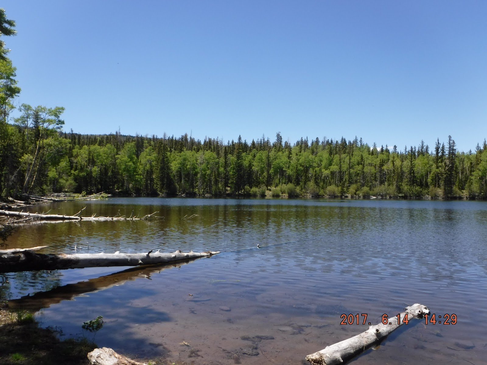
It's about a ten-mile ride from the park to the closest trail heads. Not great, but the ride is easy and the views pretty. It continues to surprise me how much snow is still on the ground in the high country.  Locals tell us they had a LOT of snow last winter as the snow is usually gone by this time.


After a day or two, the charming couple below pulled into the site next to us.  (Odd coincidence:  Bob was the corporate pilot for Rousch Yates Racing Engines for 10 years.  Madison is working for Rousch Yates.)  

Bob and Jolee live in North Carolina and drift back and forth between there and Las Vegas where their son lives.  We thoroughly enjoyed the time we spent with them. They were thrilled to play with Muppet and Lola.  One morning I let the dogs out and they went to Bob and Jolee's door and waited for them to appear.  They (the dogs) were very disappointed when I made them come back.


We made the run up to the mountain a couple of times.  As it was at Torrey, it is still late spring at the higher elevations.  The aspens aren't quite leafed out and there are flowers everywhere.  We topped out at about 10,000 feet and found a snowbank for the pups to play.  Notice that Indy and Muppet are just walking around; Lola is rolling, squirming, generally having a great time.


Lola loves the snow....


We discovered after four days in Koosharem with NO internet connection unless we drove down to the cafe that we have become dependent on it.  Both of us use it to pay bills and keep up with events.  So we will inquire at each potential park whether they have decent wi-fi (many have it but it's not usable) and a strong Verizon signal.

Next stop on the tour was Ferron, Utah, where there was supposed to be good riding.  We spent a month or two there one week.   Same problem we have had in other USFS locations:  trails are limited to rigs 50" or less.  Mike's Wolverine is 63".  We went to the local USFS office for a map and information.  The guy behind the counter marked a map for us with two trails which once were 50" but have been modified for larger off-road vehicles.  

O well, how hard can it be?  They say the trail will accommodate 66" vehicles...


And there were a couple of other little bridges without sides.  Mike's rig barely fit.  This is definitely a "no mistakes" trail.  The riding for the first few miles was interesting and challenged driving skills (mine).  After the first few miles, though, it became basically a county gravel road leading to a reservoir.  Pretty drive but not what we like to ride.

Joe's Valley Reservoir
There was one other trail marked on the map by the USFS guy as having been modified for 66" vehicles.  However, it required a 15 mile run up a mountain on a gravel county road just to get to the trail head.  

We really weren't looking for this trail but when we stumbled on the trail head, we decided to run it.  The first half was routine dirt and rock.  And then we got to the last half.  White-knuckle (for me) in spots, as it was narrow, steep, rough, and at points ran along the edge of a deep canyon as the trail worked it was back down to the flat.  

When we finally got down to the bottom, there was a long stretch through the canyon to get back to the highway.  The canyon bottom is littered with GIANT BOULDERS and you weave your way along.  I found myself looking up at the steep canyon walls, wondering when the next boulder was going to detach and come crashing down.

The surprise was that we came out ten miles south of Ferron, on the highway.  There's a coal-fired power plant north of Ferron at Castle Dale and coal fields south of Ferron.  Enormous double trailer trucks go back and forth delivering the coal to the plant.  There's no ATV trail adjacent to the highway so you ride on the wide shoulder, with the behemoths coming up behind you at 80 mph.  Two long bridges also add a certain level of excitement to the ride. 

There is BLM land with trails to the east of Ferron and we went that way one day, much to our mutual frustration.  There were trails marked on the map which had no trail marker; trails with markers which were not on the map; BLM staging points with maps which were too small and did not show where YOU are.  After a hot, miserable ride, we turned around and came back to the park, swearing at the BLM.  These trails run through the San Rafael Swell and we were looking forward to seeing the sights.  The part we saw was spectacular but we couldn't appreciate it due to our frustration with being lost.

When I mentioned this to the park guy, he said the BLM sent out a team a year or so ago to survey and map the trails and place markers.  The local ranchers who have the leases remove the trail markers and close trails which should remain open.  No wonder we had such a hard time.  

Lost in the San Rafael Swell.
The park in Ferron is a rather strange place.  While our standards for parks are low, this one was pushing the bottom.  It had the minimum requirements for us:  working utilities, a level site, and quiet.  And that was it.  I chatted with the guy who lives here and sort of manages the park.  He said that at one time, Ferron was a prosperous place owing to the coal deposits found around there.  As the coal industry foundered, many of the park's residents left the area.  Now only a handful of trailers are left and several of those are dilapidated, with junk strewn everywhere.


Note to those of you visiting southern Utah:  three times in grocery stores we have encountered something called Champ Chicken. They make three kinds of kebabs, teriyaki, orange, and barbecue, and all three kebabs are excellent.  Look for the kebabs at the deli counter!

We are now at Fillmore, UT, which will be featured in the next post.


Saturday, July 1, 2017

Torrey

Torrey, UT, is just west of the entrance to Capitol Reef National Park.  If not for the park, Torrey would not exist.  As it is, it's a few businesses strung along a couple of miles; eating places, atv rentals, guided tours, RV parks, etc.

We are finding, to Mike's immense disappointment, that many/most of the trails in Utah are limited to rigs 50" or less in width.  The trails were originally created for 4-wheelers, not for side-by-sides.  The US Forest Service is reluctant to spend the time and money to remove barriers or widen narrow spots to accommodate anyone with a larger rig.  While I understand why they want to keep trucks and Jeeps off trails (they are too big, too heavy, and they damage the trails), USFS is restricting anyone with a larger rig from the trails.  We see many 50" rigs here in Utah and that's why.


Torrey's trails are part of the Great Western Trail system.


The first full day we were in Torrey, we found a trail which was open to rigs of any size.  In theory, Jeeps and trucks could traverse at least part of the trail but then it narrowed down and 
got STEEP.  The views from near the end of the trail back east were beautiful.


On another run up the mountain, we encountered one of the local tour guides taking clients for a ride.  He quietly told us of a 50" trail that a larger rig could take safely; he also said the locals are lobbying the USFS to make more trails accessible to the bigger rigs.


 Mike did a little test run to see if his Wolverine would fit through the two boulders which limit access.  You can't see the boulder on his right side but it's about the same size as the one on his left.


This is the trail.  It's tight hairpin turns and as you keep going up, it gets steeper and steeper, with no place to turn around if you decide it's too much.  It's roughly 10,000 feet when you top the crest. 

Oddly enough, we encountered cattle up there.  There must be another way up because there's no way anyone could drive a herd up this trail.


Below is a view of the trail from the top.  Just imagine taking your rig out and into what appears to be empty space as you start back down.  (There's only one way back, the way you came up.)


We had "heard" there were good trails across the highway to the south so we ventured out there one day.  The first two trails we tried were obviously 50" trails (although they were not marked) and we wandered around for probably 90 minutes trying to find a trail where we could be legal.  Success at last!  Not very interesting riding, as it was just a really rocky, rutted trail used by the local ranchers to move cattle from one pasture to another on the mountain (more on this later).  We were trying to get to Donkey Reservoir at the top of the mountain but we wasted so much time early that we only got to Round Lake.  The safe decision was to turn around and start back down.

 Round Lake is a beautiful place but the mosquitoes are hungry and numerous.  
When we had started up the trail, another off-roader stopped to tell us that a local rancher was going to be moving cattle on the trail at some point that afternoon.  We fortunately were at a wide spot where we could get out of their way when we encountered them.  The cattle had a perfectly clear, flat trail and they all decided to climb the hill.  The cowboys had to go after them and drive them back to the trail.  


Twice in the past three weeks, one of Mike's eyes has been seriously swollen thanks to bites by the notorious cedar gnat. These flying nanovampires inflict a bite at least as bad as a mosquito bite and maybe even worse.  I've talked with a lot of locals (including a pharmacist) and no one has a very good repellent.  OFF doesn't do much to repel them.  They seem to like it.

We returned to the park one Friday afternoon and the manager came around to tell us the water was being shut off indefinitely.  The water for Torrey comes from the mountain north of town (where we had been riding) and an old pipe broke.  I scurried around and filled our on board tank immediately, even though the water wasn't supposed to be turned off until 6 p.m.  Guess what...water was turned off at 4:30 p.m. to the entire town, including motels, restaurants, RV parks, everything.  A weekend without water in hot weather in southern Utah.  Splendid.

There is a small town just west of Torrey named Bicknell.  Some enterprising soul bought the old, rundown movie theater, fixed it up, and opened for business.  For Faithful Readers from Coffeyville, it reminds me of the Midland but smaller.  Their snack bar has excellent ice cream and they open at 11:00 am.  


Next stop:  Koosharem to ride trails around Fish Lake.